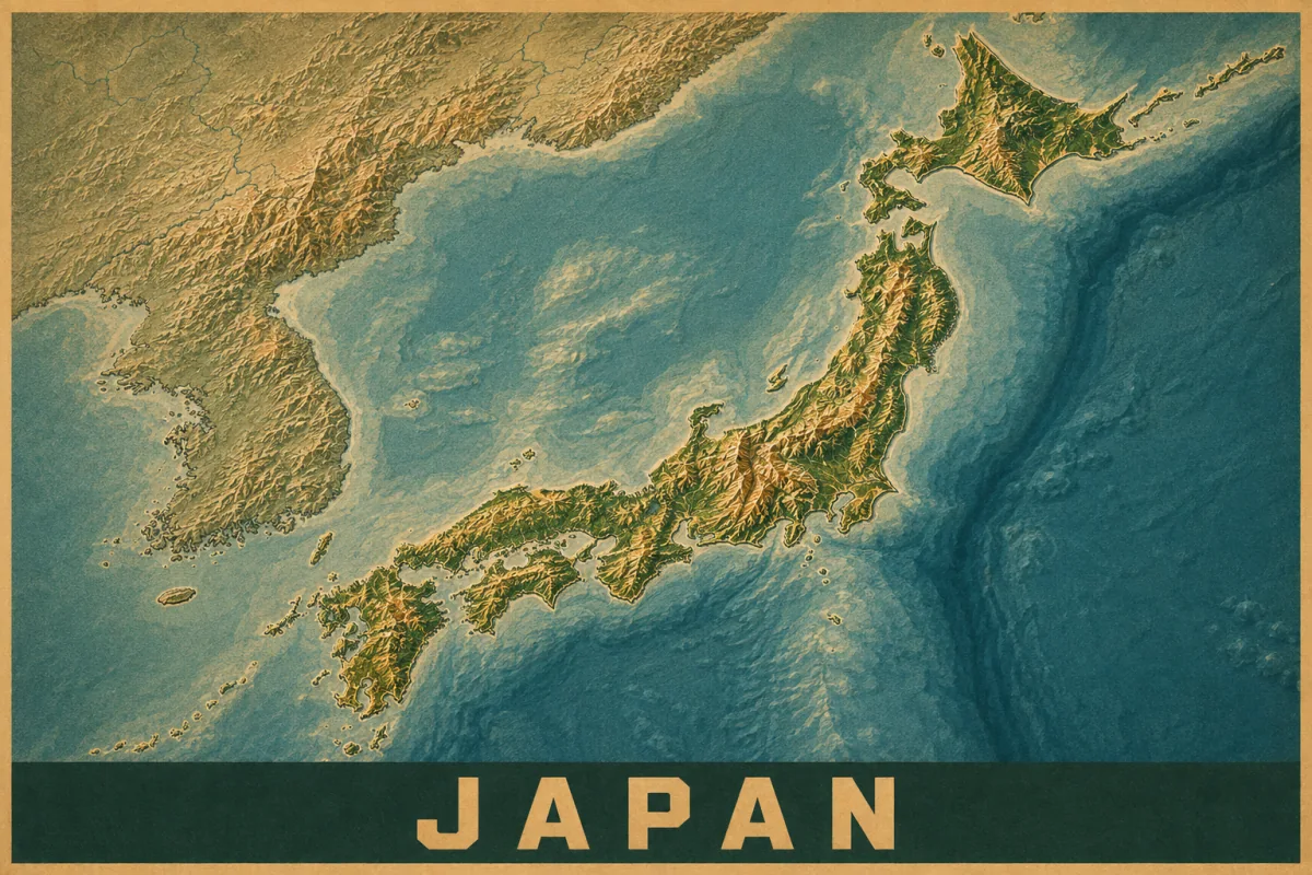
Japan has frequent earthquakes because several tectonic plates meet beneath and around its islands. The Pacific and Philippine Sea plates descend beneath neighboring plates, building stresses that can be released in earthquakes. JMA explains the plate movements behind this activity.
The geography gives you a starting point. The report for an individual earthquake adds the details: its location, depth, magnitude, and the shaking observed in different places.
Why does Japan have so many earthquakes?
Around Japan, oceanic plates move a few centimeters a year and sink beneath other plates in a process called subduction. Earthquakes can occur in several settings:
- At the plate boundary, where the descending plate and the plate above it slip against each other.
- Inside the descending plate, sometimes well below the surface.
- On shallow faults in the upper plate, including faults beneath land.
This helps explain why an earthquake map shows both offshore events and inland clusters. A shallow inland earthquake can cause severe local damage even when its magnitude is smaller than that of a great offshore earthquake. JMA’s guide to earthquake types illustrates these different settings.
For the broader picture, explore tectonic plates and the Pacific Ring of Fire.
The Japan Trench and the Nankai Trough
Off eastern Honshu, the Japan Trench follows the boundary where the Pacific Plate descends beneath Japan. Farther northeast, that subduction system continues along the Chishima, or Kuril, Trench near Hokkaido. These offshore boundaries have produced large earthquakes.
The Nankai Trough, along Japan’s southern Pacific margin, is another major earthquake region. Its past large ruptures have varied in their timing and extent. JMA monitors it and can issue extra information when observations indicate an elevated likelihood of another large event. That information does not specify a certain earthquake date, and a large earthquake can occur without such information being issued first. JMA describes the monitoring and its limits.
What does “shindo” mean?
Japanese earthquake reports distinguish magnitude, the size of an earthquake at its source, from seismic intensity, or shindo, the shaking measured at a location. One earthquake can produce many intensity readings.
JMA uses ten intensity categories: 0, 1, 2, 3, 4, 5 Lower, 5 Upper, 6 Lower, 6 Upper, and 7. These are categories of local shaking, not earthquake magnitudes. Ground conditions and a building’s response can also make the experience differ within the same city. JMA’s intensity scale explains the observations associated with each level.
For example, a report of maximum intensity 5 Upper describes the highest local category recorded for that event. It does not mean the earthquake had magnitude 5. Read magnitude vs. intensity for the distinction, or use the magnitude comparison calculator to compare earthquake sizes.
Two major earthquakes in Japan
These examples show why a report needs more than one number. Dates below are local dates in Japan, and the magnitude and maximum-intensity values are from JMA.
| Earthquake | Date | Magnitude | Maximum JMA intensity |
|---|---|---|---|
| Tōhoku / Great East Japan | March 11, 2011 | 9.0 | 7 |
| Noto Peninsula | January 1, 2024 | 7.6 | 7 |
The 2011 Tōhoku earthquake occurred offshore and generated a devastating tsunami. JMA identifies it as the largest earthquake recorded in Japan. You may also see M9.1: that is the value in the USGS historical list, which our largest earthquakes guide uses. Check the reporting agency when comparing numbers.
The 2024 Noto Peninsula earthquake reached the same maximum JMA intensity category despite its smaller magnitude. JMA’s record also documents numerous subsequent earthquakes. The two maximum-intensity values do not imply identical shaking throughout the affected areas or identical consequences.
How Japan’s earthquake early warnings work
JMA’s early warning system analyzes an earthquake after it starts, aiming to alert people before strong shaking reaches them. It may provide seconds to take protective action. It does not predict an earthquake days in advance. JMA explains Earthquake Early Warnings.
Close to the source, strong shaking may arrive before a warning. Rapid estimates also have limits, particularly when earthquakes are very large or occur close together. JMA explains these limitations. Earthquake Alert’s maps and reports do not provide this early warning service.
Earthquakes and tsunami warnings
Tsunami warnings are a separate part of an earthquake response. JMA evaluates the potential for a tsunami and issues information for coastal regions that may be affected.
Near the coast, strong shaking or prolonged weak shaking is a reason to evacuate immediately to higher ground or a designated tsunami evacuation building. A nearby tsunami can arrive before an official warning. Tsunami waves can repeat, so stay in the evacuation area until warnings are cleared and follow local instructions. These actions come from JMA’s tsunami guidance.
Where to check recent Japan earthquakes
Use JMA’s earthquake information in English for reports and observed intensity readings. For tsunami information, follow the current warnings linked from JMA’s tsunami service.
On this site, the Japan-centered globe lets you compare recent USGS earthquake locations with plate boundaries. Its markers show recent events rather than the historical earthquakes above. For the science behind clusters that follow a larger event, continue to aftershocks explained.
Sources & further reading
- JMA: Why earthquakes happen and where they occur (Japanese)
- JMA: Earthquake monitoring and the Nankai Trough
- JMA: Seismic intensity scale
- JMA: The 2011 Great East Japan Earthquake
- JMA: The 2024 Noto Peninsula Earthquake (Japanese)
- JMA: Earthquake Early Warnings
- JMA: Tsunami warnings, advisories, and protective action
By Josh Clemm · Reviewed September 6, 2026. Educational information from Earthquake Alert; no earthquake early warnings.