Understanding Earthquakes
An earthquake is a sudden, rapid shaking of the ground caused by the shifting of rocks deep beneath the Earth’s surface. This natural phenomenon occurs when accumulated energy is released along geological fault lines, during volcanic activity, or by man-made explosions.
Causes
The primary cause of earthquakes is the movement of tectonic plates, the massive rock slabs that make up the Earth’s crust. These plates are constantly moving, but they can get stuck at their edges due to friction. When the stress on the edge overcomes the friction, an earthquake occurs. Other causes include volcanic activity, which can produce earthquakes, and human activities like mining or reservoir-induced seismicity.
Types of Earthquakes
- Tectonic Earthquakes: These are caused by the sudden release of energy due to the movement of the Earth’s plates. They are the most common type of earthquake.
- Volcanic Earthquakes: These occur in conjunction with volcanic activity and are typically less powerful than tectonic earthquakes but can still be quite destructive.
- Collapse Earthquakes: Small earthquakes in underground caverns and mines, caused by seismic waves produced by the roof collapse.
- Explosion Earthquakes: Result from the detonation of nuclear and chemical devices.
The Science Behind the Shaking
Seismic Waves
When an earthquake occurs, it releases energy in the form of seismic waves that travel through the Earth’s interior and across its surface. There are two primary types of seismic waves: body waves (P-waves and S-waves) and surface waves. P-waves are the fastest, traveling through liquids and solids, while S-waves are slower and only move through solids. Surface waves are the slowest but cause the most damage.
Measuring Earthquakes
- Richter Scale: Developed by Charles F. Richter in 1935, this scale measures the magnitude of an earthquake, which is a number that represents the size of the quake at its epicenter. It’s a logarithmic scale, meaning each whole number increase on the scale represents a tenfold increase in measured amplitude.
- Moment Magnitude Scale (Mw): This scale has largely replaced the Richter Scale for large, distant, or deep earthquakes. It measures the total energy released by an earthquake and is more accurate for larger events.
Fault Lines
A fault line is a fracture or zone of fractures between two blocks of rock. Faults allow the blocks to move relative to each other. This movement may occur rapidly, in the form of an earthquake, or may occur slowly, in the form of creep. Major fault lines, like the San Andreas Fault in California, are known for their potential to cause significant earthquakes.
Anatomy of an Earthquake
Focus and Epicenter
- Focus (Hypocenter): The point within the Earth where the earthquake rupture starts. It’s the location at which the strain energy stored in the rock is first released.
- Epicenter: The point on the Earth’s surface directly above the focus. The location of the epicenter determines where the strongest shaking is felt on the surface.
Seismographs
Seismographs are instruments used to record the motion of the ground during an earthquake. They are equipped with sensors to detect the slightest ground movements, including the intensity and duration of seismic waves.
Aftermath
- Aftershocks: Smaller earthquakes that follow the main shock and originate at or near the focal point.
- Tsunamis: Large ocean waves generated by undersea earthquakes, which can travel across oceans and cause widespread destruction upon reaching coastlines.
- Landslides: Earthquakes can destabilize slopes, leading to landslides, especially in mountainous and hilly areas.
Major Tectonic Plates
Tectonic plates are massive pieces of Earth’s crust that move over the viscous upper mantle. The Earth’s lithosphere is divided into several major and minor plates, which are constantly shifting and interacting at their boundaries. This section explores the major tectonic plates, their characteristics, and how their movements affect the planet.
The Seven Major Tectonic Plates
- African Plate: Covering the continent of Africa and extending into the surrounding oceanic crust.
- Antarctic Plate: Encompassing the continent of Antarctica and a large portion of the Southern Ocean.
- Eurasian Plate: Stretching from the Atlantic Ocean to the Far East, encompassing Europe and Asia.
- Indo-Australian Plate: A major plate under the Indian Ocean and parts of the Indian and Australian continents.
- North American Plate: Covering North America and extending into the Atlantic Ocean.
- Pacific Plate: The largest and oldest plate, covering most of the Pacific Ocean.
- South American Plate: Including the continent of South America and a portion of the Atlantic Ocean.
.svg)
Explore the tectonic plates on an interactic globe to learn more
Plate Boundaries
- Convergent Boundaries: Where plates collide, resulting in mountain ranges, earthquakes, and volcanic activity.
- Divergent Boundaries: Where plates move apart, causing mid-ocean ridges and rift valleys.
- Transform Boundaries: Where plates slide past each other, leading to earthquakes.
Notable Seismic Areas
Let’s go through a few notable examples of where the tectonic plates impact our world.
The Ring of Fire
The Ring of Fire is a major area in the basin of the Pacific Ocean where a large number of earthquakes and volcanic eruptions occur. Spanning about 40,000 kilometers (25,000 miles), it’s a horseshoe-shaped zone that is home to 75% of the world’s active and dormant volcanoes. This section explores the geology, significance, and impact of the Ring of Fire.

Explore the ring of fire on an interactic globe to learn more
Geological Features
- Volcanoes and Earthquakes: The Ring of Fire is characterized by intense seismic activity, including frequent earthquakes and volcanic eruptions.
- Plate Boundaries: This region is a string of subduction zones, where oceanic plates sink beneath lighter continental plates, leading to volcanic activity.
- Major Volcanoes: Includes famous volcanoes like Mount St. Helens in the United States, Mount Fuji in Japan, and Mount Pinatubo in the Philippines.
Major Historical Earthquakes in the Ring of Fire
- 1960 Valdivia Earthquake (Chile)
- Date: May 22, 1960
- Magnitude: 9.5 (largest earthquake ever recorded)
- Impact: This catastrophic earthquake and the resulting tsunamis affected southern Chile, Hawaii, Japan, the Philippines, and the west coast of the United States. It caused widespread destruction and thousands of deaths.
- 1960 Valdivia Earthquake - Wikipedia
- 2011 Tōhoku Earthquake and Tsunami (Japan)
- Date: March 11, 2011
- Magnitude: 9.1
- Impact: Triggered a massive tsunami, leading to the Fukushima Daiichi nuclear disaster. It was one of the deadliest earthquakes in Japan, causing over 15,000 deaths and significant infrastructural damage.
- 2011 Tōhoku Earthquake and Tsunami - Wikipedia
- 2004 Indian Ocean Earthquake and Tsunami
- Date: December 26, 2004
- Magnitude: 9.1-9.3
- Impact: Generated a series of devastating tsunamis, affecting 14 countries and causing over 230,000 deaths, making it one of the deadliest natural disasters in recorded history.
- 2004 Indian Ocean Earthquake and Tsunami - Wikipedia
- 1964 Alaska Earthquake (USA)
- Date: March 27, 1964
- Magnitude: 9.2
- Impact: The second-largest earthquake ever recorded, it caused significant ground shaking, tsunamis, and destruction in Alaska, with effects felt in Oregon and California.
- 1964 Alaska Earthquake - Wikipedia
- 1952 Kamchatka Earthquake (Russia)
- Date: November 4, 1952
- Magnitude: 9.0
- Impact: Resulted in tsunamis reaching Hawaii, Japan, Alaska, and the Philippines, with considerable property damage but relatively low loss of life.
- 1952 Kamchatka Earthquake - Wikipedia
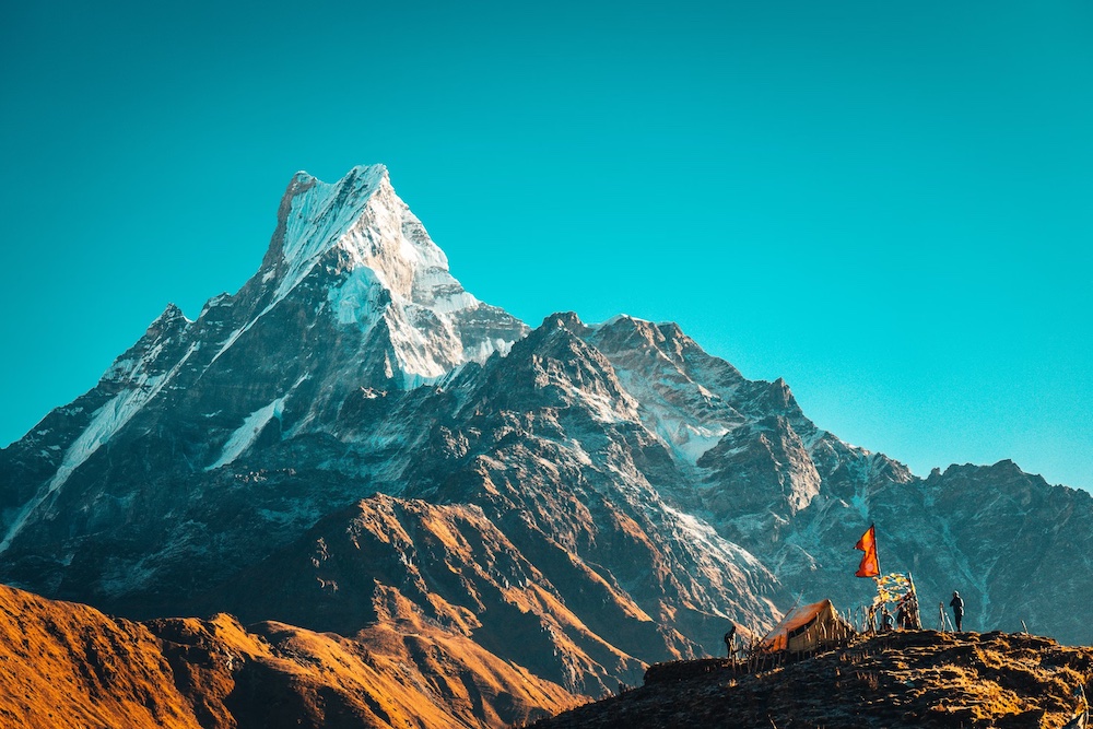
Formation of the Himalayas
The Himalayas, often referred to as the “Roof of the World,” are the highest mountain range on Earth, extending across five countries in Asia. This majestic range is a result of the tectonic activities involving the massive Indo-Australian and Eurasian Plates. This section delves into the geological history and processes behind the formation of the Himalayas.
Tectonic Origins
- Collision of Plates: The Himalayas were formed from the collision of the Indo-Australian Plate with the Eurasian Plate. This monumental event began about 50 million years ago and continues to influence the region’s geography and seismic activity.
- Subduction and Uplift: As the Indo-Australian Plate moved northwards, it began to subduct beneath the Eurasian Plate. The intense pressure and friction led to the folding and uplift of sedimentary rocks, giving birth to the Himalayan range.
Stages of Formation
- Initial Collision: The first contact between the two plates, leading to the formation of a series of small hills.
- Uplift of the Tibetan Plateau: As the collision continued, the Tibetan Plateau began to rise, creating a larger barrier.
- Formation of the High Himalayas: The ongoing pressure resulted in the uplift of the highest peaks, including Mount Everest.
Impact on Climate and Biodiversity
- The Himalayas have a profound impact on the climate, creating a barrier that affects weather patterns in Asia.
- This range is home to unique ecosystems and a diversity of flora and fauna, some of which are endemic to the region.
Seismic Activity
- Due to the ongoing tectonic collision, the Himalayan region is prone to significant seismic activity, leading to frequent earthquakes.
- Historical records and geological studies of the area provide insights into the seismic risks associated with living in proximity to this young mountain range.